
New Malacca port plan poses threat to endangered dolphins
The project site would also be close to the first proposed marine park in Malacca.
An environmental impact assessment (EIA) report submitted by Far East pointed out that the Malacca Strait is frequently visited by...
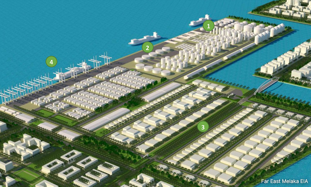
Construction company Far East Melaka has plans to build a 481.5ha deep-sea port in Malacca, but environmental groups warn the large-scale reclamation project will pose a threat to endangered marine animals such as dolphins and turtles.
The project site would also be close to the first proposed marine park in the state.
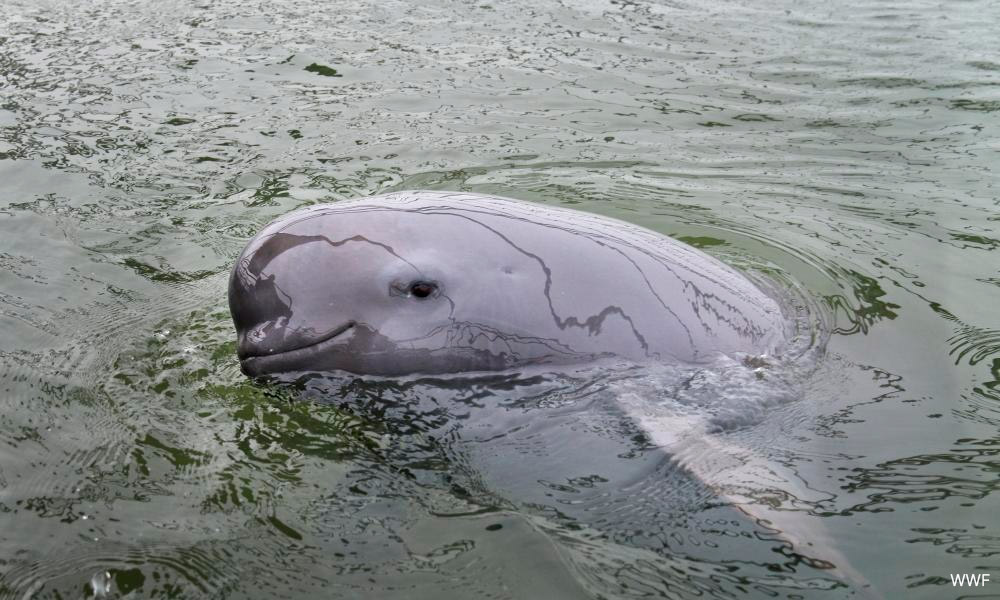
An environmental impact assessment (EIA) report submitted by Far East pointed out that Indo-Pacific humpback dolphins (listed as vulnerable on the IUCN Red List) and Irrawaddy dolphins (listed as endangered) frequently visited the Malacca Strait, including in the vicinity of the proposed port location.
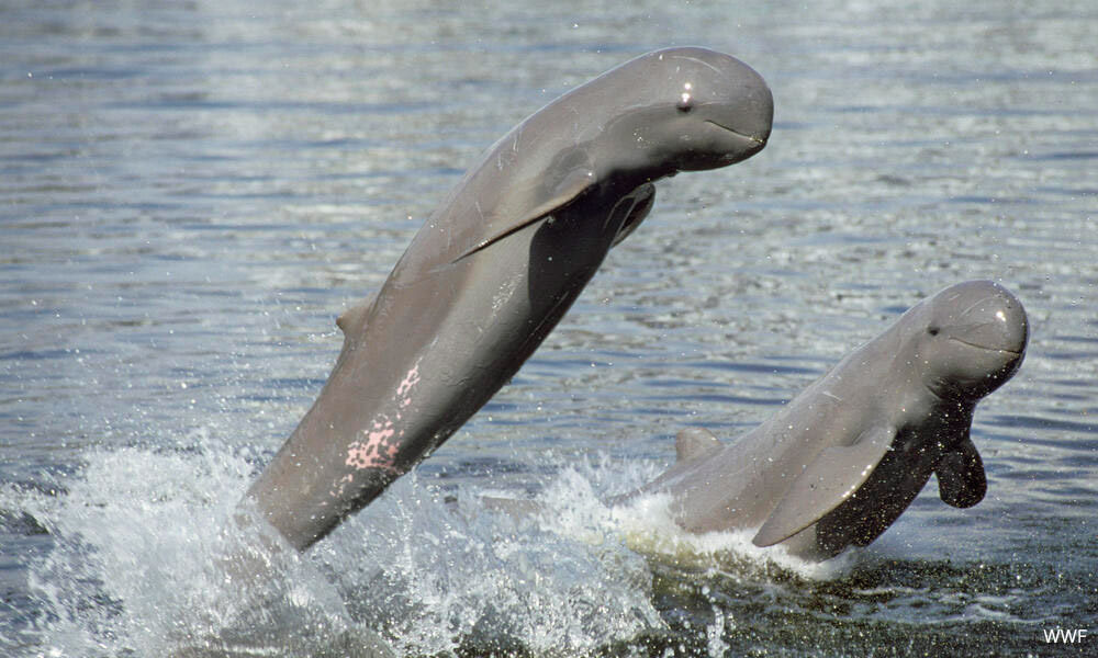
“A study (in 2000) reported sightings of two Indo-Pacific humpback dolphins near Pulau Besar, Malacca, in November 1999,” the report said.
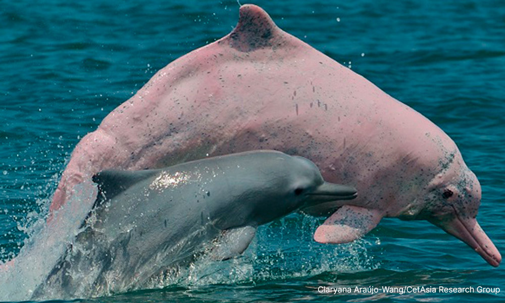
“A pair of dolphins, possibly Indo-Pacific humpback dolphins or Irrawaddy dolphins, were also sighted off Pulau Upeh on Dec 22, 2020. Both islands are located within 6km of the impacted area of the proposed reclamation project.”
The EIA found that previously, a small cohesive group of dolphins were commonly sighted off Pulau Upeh, just off the Malaccan coast. However, their presence is now only occasionally observed due to extensive human activities along the coastline.
It is worth noting that another reclamation developer, Bitara Niaga Development, stated in its EIA report submitted last November that two sightings of Irrawaddy dolphins and one sighting of Indo-Pacific humpback dolphin happened in the waters about 8km from the proposed port location.
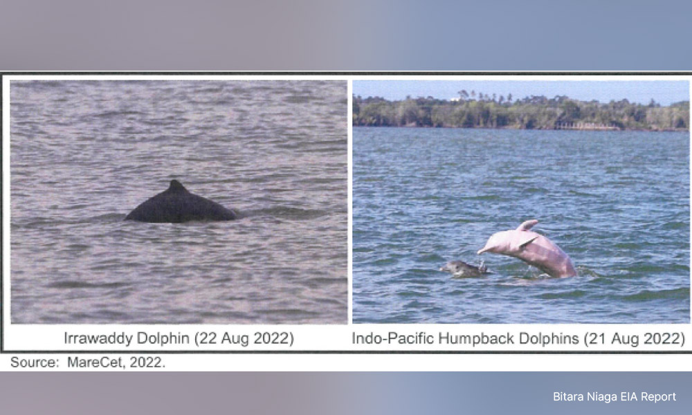
In other words, the proposed project is located near the habitat of many endangered dolphins.
Stranded dolphins die on beaches
There have been instances of dolphins being stranded and dying on the beaches of Malacca.
The EIA report stated two incidents of dolphins being stranded, which took place in June 2015 and September 2018 and the incidents happened within 19km of the proposed port site.
“An incident in 2018 was reported at Tanah Merah Jaya beach, Pantai Puteri, which is located within 15km from the proposed project site. A carcass of an Indo-Pacific finless porpoise was found at the site. It was later revealed that the juvenile porpoise (estimated length of 1.4m) died due to stress and malnutrition,” the report said.
In another incident, an adult Irrawaddy dolphin was found dead with severe bruises on its bottom right flipper and was believed to have spent a few days prior to the incident without food.
The report did not state the causality between the stranded dolphins and the land reclamation project. However, the report stressed that dolphins are very sensitive to unfamiliar movement or sound, including barges and sand carriers which “could potentially disturb dolphin activities”.
“The amount of noise produced by barges and sand carriers depends on a number of factors… generally the larger the size of the vessel and the faster the speed, the higher the noise level generated.
“During the movement of the vessel, dolphins will swim away from the pathway. This may disturb the feeding activities of the species.”
Reclamation activities disturb turtles
Besides dolphins, the EIA report highlighted the existence and habitat of endangered turtles in the waters.
It pointed out that within a 6km radius of the proposed port site, there are three turtle landing sites - Pulau Besar, Pulau Lalang and Pulau Upeh.
The report stated that sediment produced by reclamation activities will not reach the islands.
However, noise and vibrations from the reclamation activities could potentially disrupt turtle navigation by preventing them from taking their normal route, hence exposing them to more dangers from predators, the report added.
Environmentally sensitive areas and marine park
The report listed several environmentally sensitive areas near the proposed port site.
In the Terms of Reference and Adequacy Report (Torac) meeting, environmental watchdog Sahabat Alam Malaysia (SAM) pointed out that the proposed reclamation site is in Rank 1 and 2 Environmentally Sensitive Areas comprising mangrove, seagrass, coral reef, mudflats and areas planned to be gazetted as marine parks.
SAM said the proposed port is located only 1.75km away from reclamation-restricted areas such as Pulau Serimbun, Pulau Besar and Pulau Lalang.
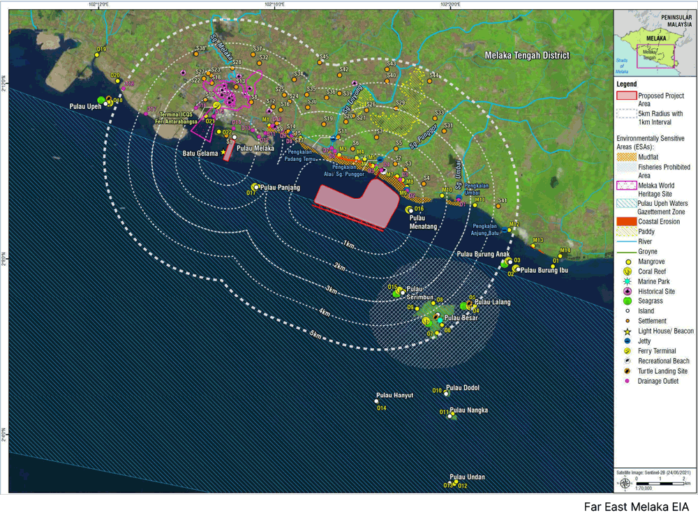
The proposed project area is also very close to the first proposed marine park in Malacca, which is less than three nautical miles from Pulau Dodol, Pulau Nangka and Pulau Undan.
“In the surrounding area, there are also many natural corals and corals grown by the Fisheries Department.
“Therefore, it is necessary to assess the impacts to these three islands designated as marine parks and marine biodiversity in the surrounding areas.”
In a reply, the developer claimed the marine park has only been proposed but has not been approved.
In 2021, it was reported that the Agricultural and Food Industries Ministry revealed a plan to gazette the three islands as the first national marine park in Malacca to ensure the sustainability of marine biodiversity in the area. It was pending approval from the state government.
Impact on mangroves, coral reef
The EIA report also pointed out that mangroves were found along the coastline from Kampung Portugis in Malacca Central to Serkam in Jasin, as well as 13 islands along the coast.
The mangroves provide shelter to marine species and reduce shoreline erosion. Mangroves may also function as a biological indicator of coastal changes and sea level rise.
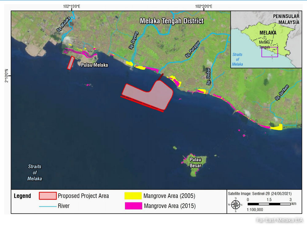
However, the EIA stressed that the area only has small irregular patches of mangroves, and no significantly large mangrove forest was found.
The report added that sediment produced by reclamation activities will not spread beyond the reclamation boundary, therefore “no significant impact is expected on mangroves found along the coastline”.
Meanwhile, the report noted the existence of coral reefs at Pulau Panjang (1.3km away from the sand transportation route) and Pulau Serimbun (4.8km away from the sand transportation route).
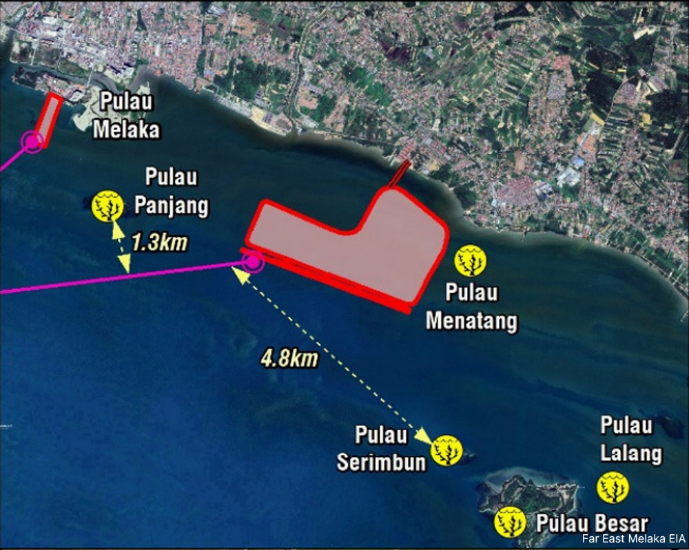
For rock transportation routes, these two islands are located 2.2km and 3.3km away respectively.
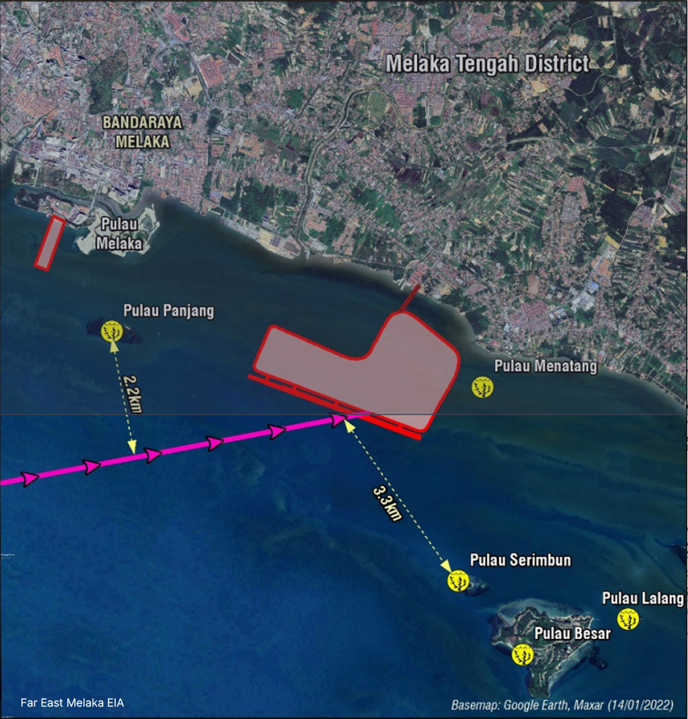
The EIA team expressed concern that the movement of rock and sand dredgers can potentially create a wake that could affect the coral reefs of these two islands.
“The wake is known to disturb the water circulation and alter tidal patterns that can disrupt the reef’s nutrient supply.
“The wake of the dredger is also known to induce turbidity, which is known to be detrimental to the corals.”
But the EIA emphasised that the buffer between the sailing route and the islands is more than 1km away, therefore “it is deduced that ship wake will not present imminent danger to the coral reefs”.
The report also stated that the coral health of the islands was mostly categorised as “poor” with coral percentage covering less than 25 percent.
Although there were already several ports planned along the Malacca Strait, Far East is seeking to build a 481.5ha (equivalent to 899 football fields) “deep-sea international multi-purpose port” near Alai.
Former Pontian municipal councillor Ling Kah Chok of MCA is the company’s major shareholder.
The EIA report also raised concerns that marine ecology and fish catches will be heavily affected, resulting in a loss of livelihood of the local fisherfolk and the fishing industry.
The public feedback session for this EIA expired on Feb 2. The consulting company that conducted the EIA report was Dr Nik and Associates Sdn Bhd.