
Geologist links prior landslides, timber and other debris to flood disaster
The chain of geological events that contributed to the disastrous floods that hit the Klang Valley and other parts of the country include prior landslides, said a leading geologist who visited several sites.
The natural disaster this time was so devastating and complex and happened so suddenly that all parties involved were not ready to perform their role, said Prof Ibrahim Komoo, a scholar who specialises in Engineering Geology, Conservation Geology and Sustainability Science.
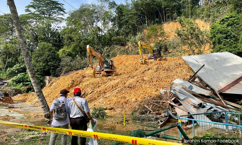
"Surveys in the Penchala River showed that floods were caused by landslides that blocked the flow of the river.
The chain of geological events that contributed to the disastrous floods that hit the Klang Valley and other parts of the country include prior landslides, said a leading geologist who visited several sites.
The natural disaster this time was so devastating and complex and happened so suddenly that all parties involved were not ready to perform their role, said Prof Ibrahim Komoo, a scholar who specialises in Engineering Geology, Conservation Geology and Sustainability Science.
"Surveys in the Penchala River showed that floods were caused by landslides that blocked the flow of the river.
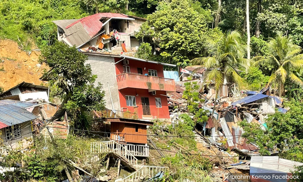
"Two large landslides, measuring 40,000 and 50,000 cubic meters respectively, destroyed more than 15 houses and evacuated 250 residents.
"We understand that hundreds of landslides and small to large debris flows occurred on Dec 19 and 20 December, along with major floods.
"So the question arises in our minds, is the massive destruction only caused by floods, or is there a cascading process responsible for producing this devastating disaster?" he said in a commentary on the Environment and Sustainability Facebook group.
"The events of the 2014 Kelantan floods and the floods at Gunung Jerai in 2020 have provided important lessons that heavy rains and floods alone do not have the energy to destroy large infrastructures and houses.
"The large amount of debris and mud carried by floodwaters has high destructive power,” he said.
Ibrahim said he had carried out a study at the site of the landslide in Sungai Penchala and the massive flood in Sungai Lui along with a group including director-general of the Minerals and Geosciences Department Hisamuddin Termidi, Geologists of Malaysia chairperson Zakaria Mohamad, president of the Geological Society of Malaysia Ahmad Nizam and Abd Rasid Jaafar, president of the Malaysian Institute of Geology.
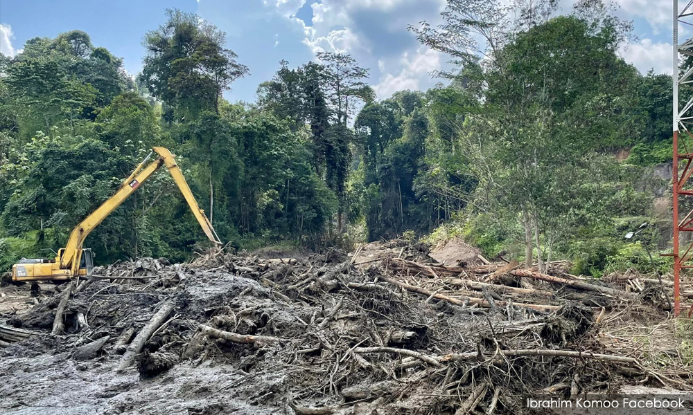
"The situation in Sungai Lui is almost the same as the phenomenon that occurred upstream of Sungai Kelantan in 2014. Hundreds of landslides and bank erosion have pumped debris (timber and bricks) into the floodwaters causing unexpected property destruction.
"In the afternoon, we went to Sungai Lui to see the devastation caused by the flooding process.
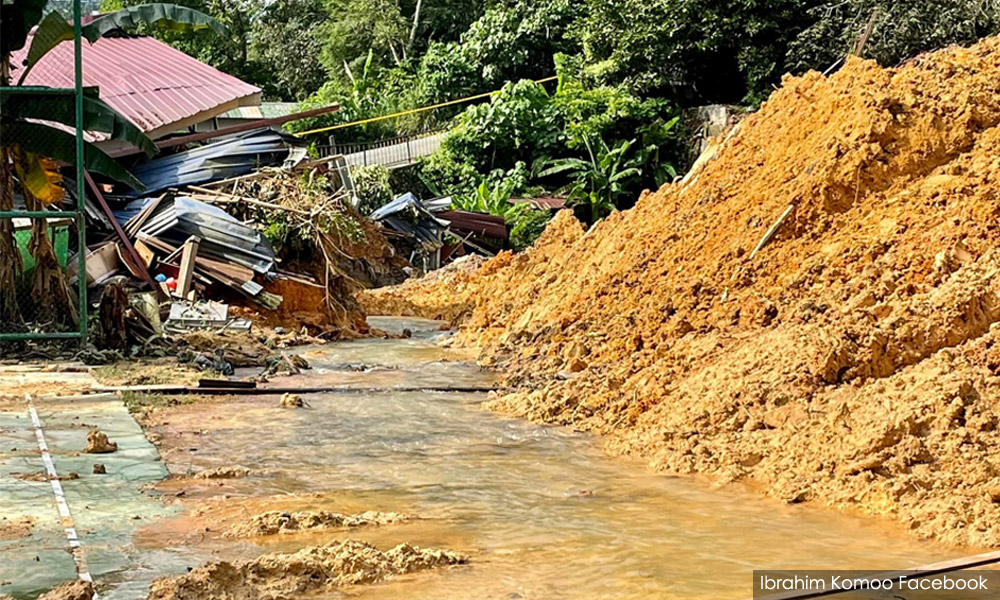
"In the uppermost part (Simpang Peras), we found two large machines clearing timber into the river.
"Meanwhile, along the 500 -meter road leading to the Sungai Lui, the road was filled with timber which has caused the destruction of several houses in the area.
"What we saw was one of probably several ‘debris flow’ incidents that occurred in the upper reaches of the Lui River. Dozens of landslide effects can also be observed on the hillside along the way from Simpang Peras to Kampung Jawa," he said.
He said that the sudden rise in water may also be due to stuck debris forming ‘temporary dams’ and then bursting causing large floodwaters.
He cautioned that all the phenomena and interpretations were based on field observations and needed to be examined and supported with further studies.
"We argue that all major flood events or are closely related to the combination of these two natural phenomena of heavy rain and landslide.
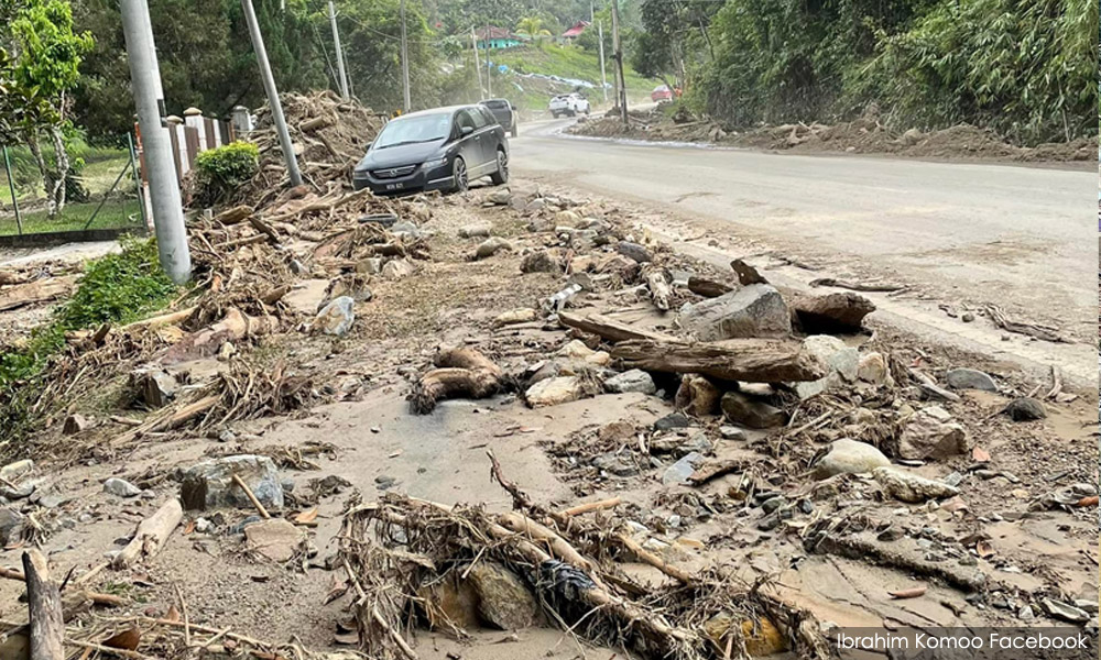
"Continuous heavy rains cause the soil in mountainous areas to saturate with water and easily slide. Due to the high quantity of water upstream of the river valley, the landslide turned into a stream of debris, subsequently into a flood of debris and followed by a flood of mud (yellow)," he said.
Ibrahim said that the disasters associated with the Klang Valley Flood of 2021 are a combination of landslides in the Pencala River, debris flows upstream of the Sungai Lui, debris floods in the Lui River valley and massive floods in most other low-lying areas in Shah Alam and Klang.
"If we intend to address the issue of natural disasters in the long run, we need to identify the causes and types of disasters, as well as take an informed approach to disaster risk reduction.
"Every catastrophic event is not just death, loss and property damage, but also a lesson to live in harmony with nature," said Ibrahim.